

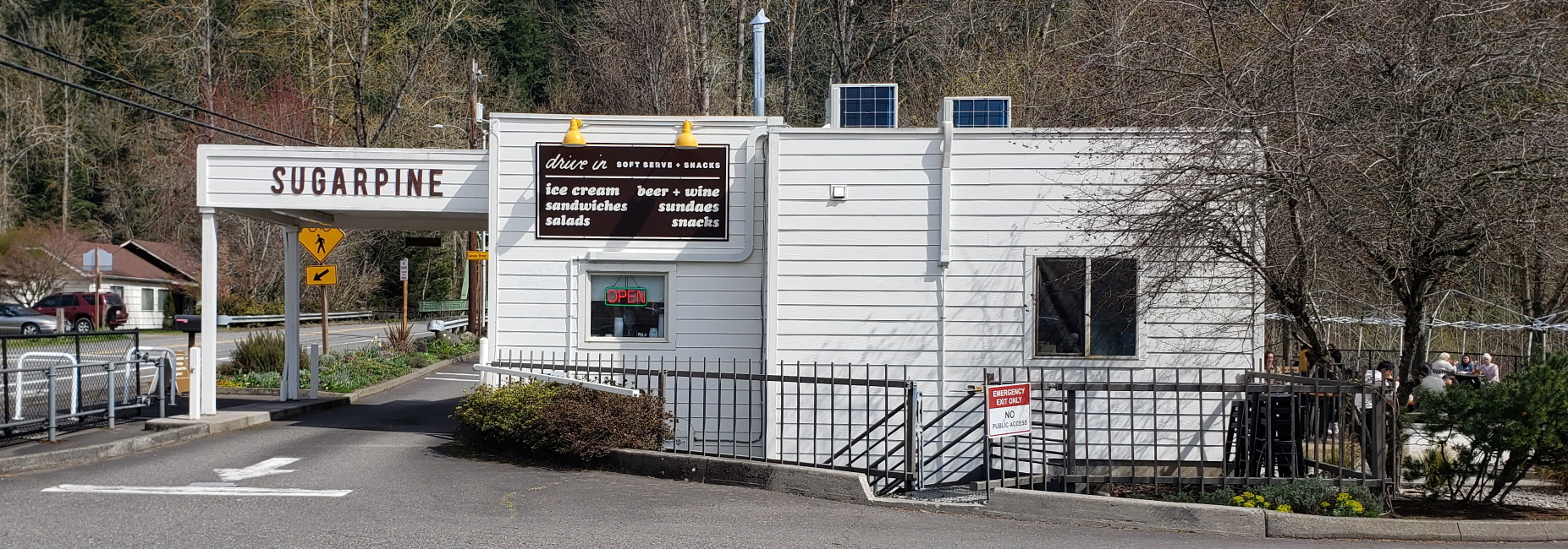
We got our lunch at the Sugarpine, a little drive-in just east of town. It’s at a riverside park where locals go down to dip in the Sandy River. (Be careful, it’s a swift-flowing river and people drown). On to a happier note, they have fantastic sandwiches, tables outside, and soft-serve ice cream. Click for a closer look.
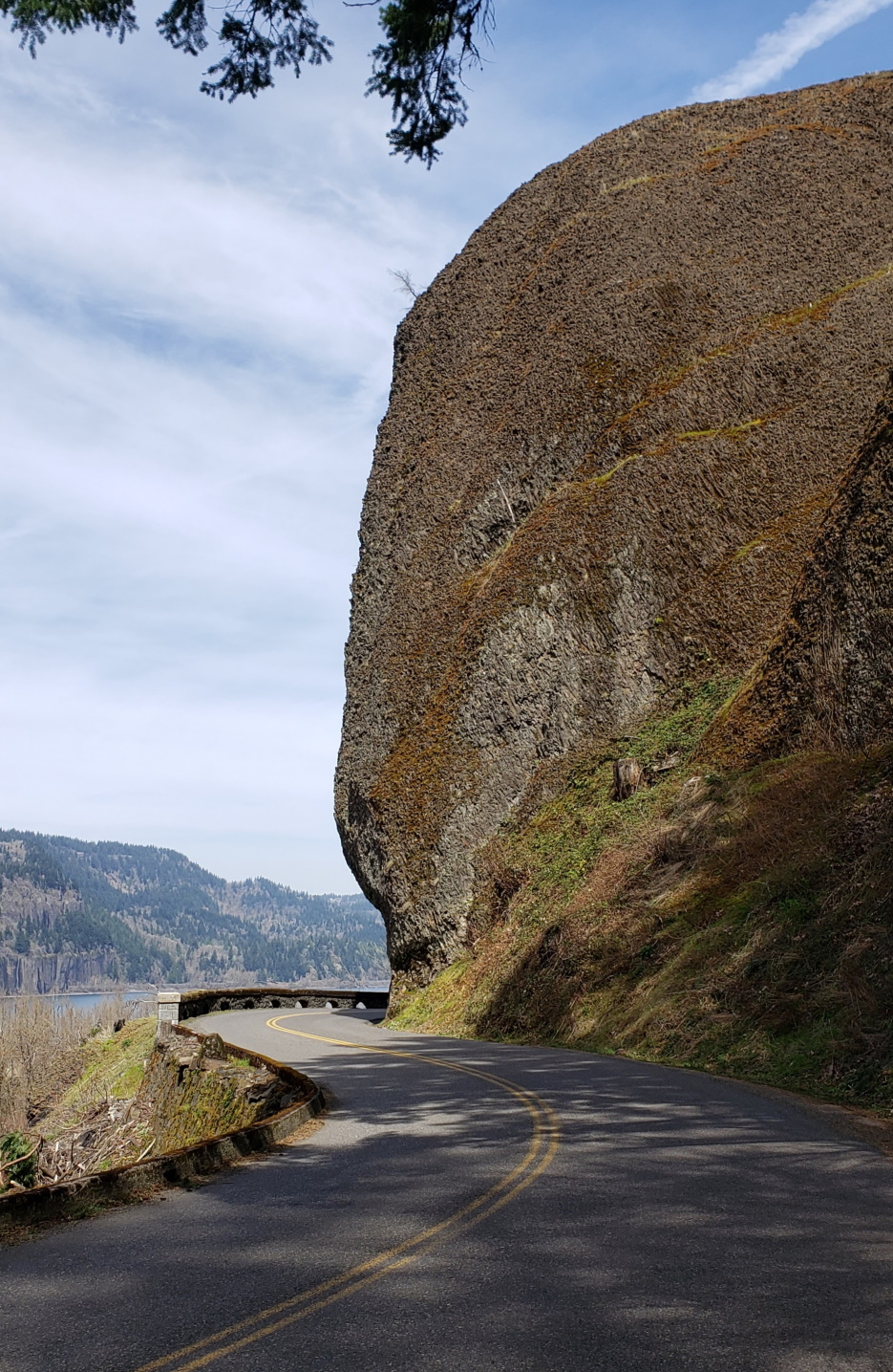
Head east past Sugarpine and turn right at the end of the bridge for the old Columbia Highway. Driving in the gorge on the old highway is scenic and fun, if you have a car that handles well. Frankly, the passenger gets the better views. This is a typical stretch of road (photo, left). As you can see, dramatic at times. If this looks too stressful, or you don’t like twisties, you can take the modern highway down by the river. However, the old road is higher up and thus has the views. It also passes by scenic landmarks like Vista House, which has parking overlooking the river (views for miles) but the Vista House itself is currently is closed (COVID, sigh). The interior of Vista House is of interest to architectural aficionados. I have a great photo of that but it is on film.

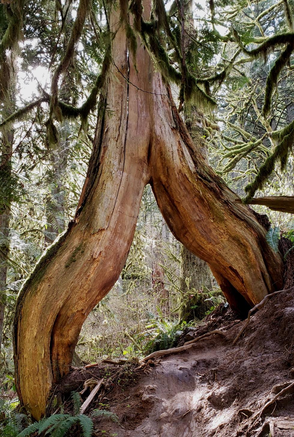
Also, on the old road you get more chances to stop and take a hike, such as at Latourelle falls. The lower falls are just a few steps from the highway but a mile of huffing and puffing (it’s steep) get to the sinuously dramatic upper falls. If you take the far side of the trail back (it adds another couple miles) you’ll pass an odd tree (below). Actually, two, but i only have room for one photo. We added Bridal Veil Falls to our itinerary as well, which is a short (0.3 mi) hike from the parking lot; a bit steep on the way back, but worth the trip. Also they have a fully equipped (i.e., soap and water, flush toilets) restroom there. Always a consideration on a road trip.
Our destination for the weekend was Hood River, Oregon. The town is fairly large for a Gorge town, as at Hood River, the characteristically high and steep bluffs of the Oregon side open up into a wide valley through which the eponymous Hood River flows. This is an important valley for Oregon, as a vast mount of fruit orchards are located here, as well as a dozen wineries, and of course the famous breweries: Full Sail brewing company, pFriem, Double Mountain to name a few. If I’m not drinking Scotch I’m having one of those. It is a mecca for art, food and drink, and sports (windsurfing, most famously). For us, it is also an excellent spot to enjoy hiking.
Why hike here? On the Washington side, there are (slightly) more gentle slopes, and this is the time of year for wildflowers. We got up reasonably early the next day and headed across the river for our adventure.

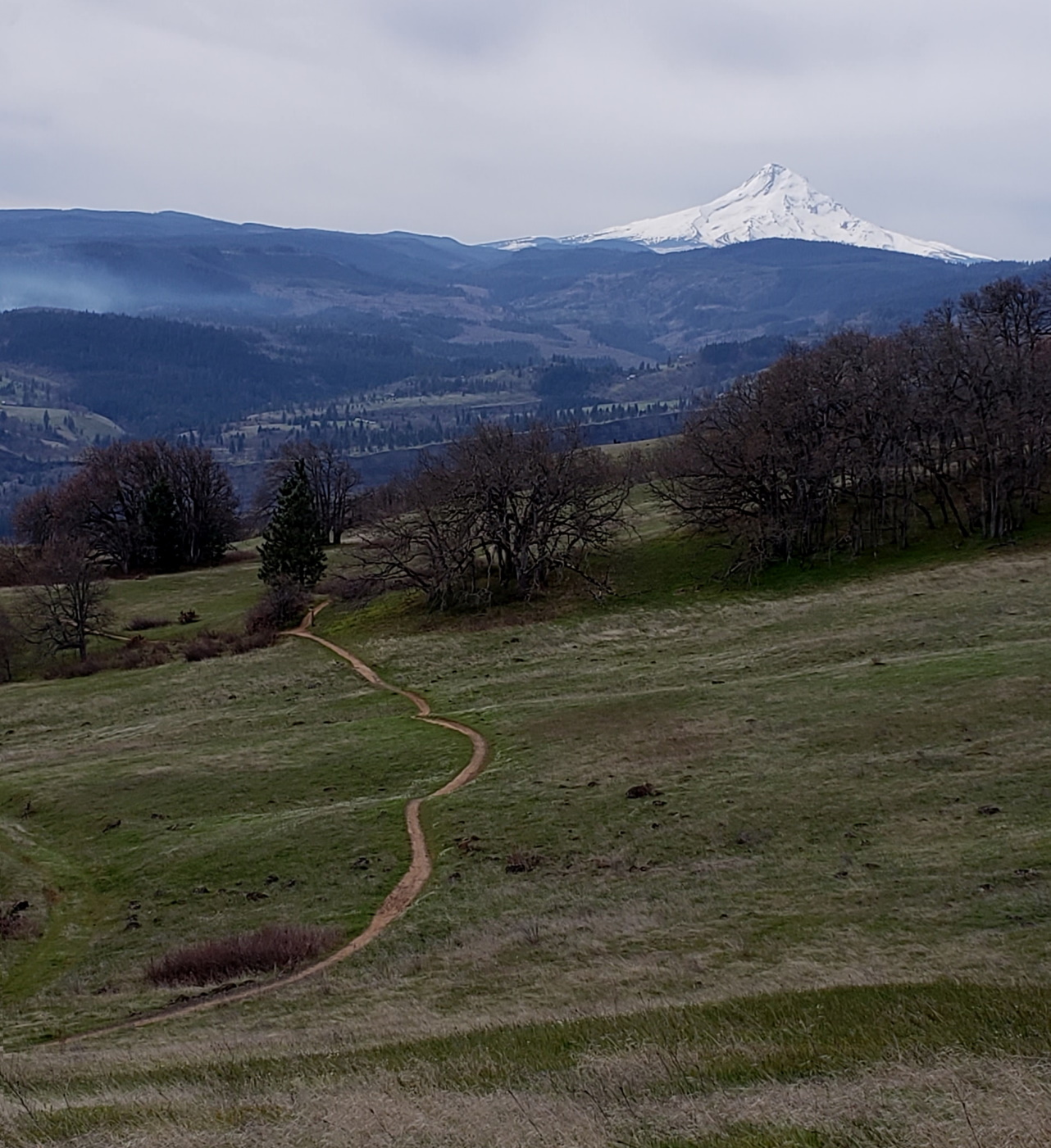
The trails, though rated ‘moderate’ require some physical conditioning and good balance,. Sometimes you’re clambering over old lava (basalt) outcroppings. It is often steep and the footing rough due to the big, chunky scree that forms the substrate for these hillsides. But the payoff is views that I’d like to think rival some famous European countrysides. Looking at you, Switzerland. (Sure, the Swiss will chuckle at that.)
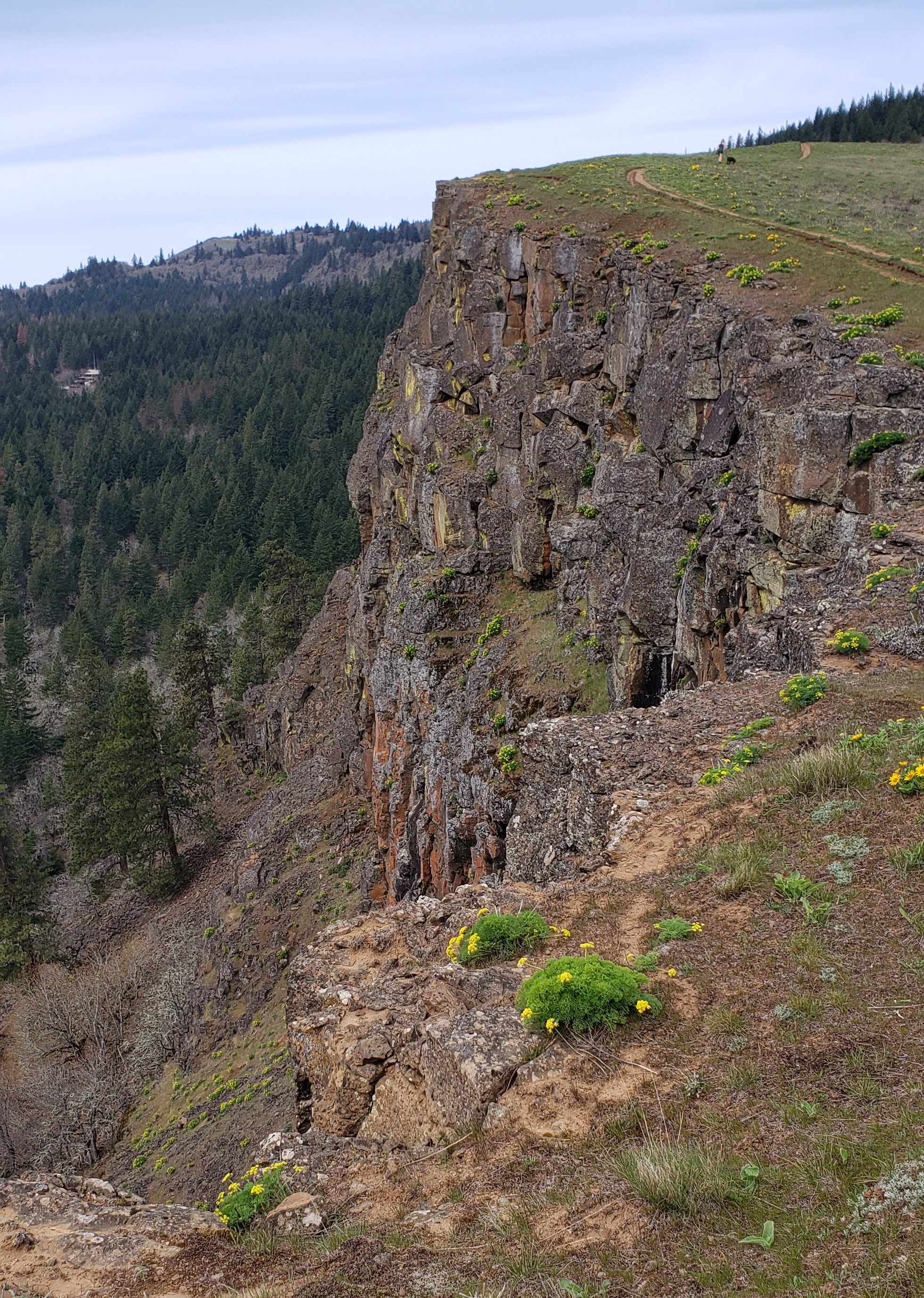
No pretty cows here, though, this is parkland now (cattle were grazed long ago). Here’s a hint: For Coyote Wall, a very high basalt cliff, do not take the most direct route as shown on the maps (or AllTrails, for example). That’s a heavily used mountain bike trail, very rough and not pleasant. Take the Labyrinth or Little Maui trails for a nicer hike. Either way, the views are marvelous. After almost 5 hours on the trails, 7.5 miles, 1600 feet elevation gain, we were ready for a break, and headed back to town for burgers and microbrews at the Sixth Street Bistro.
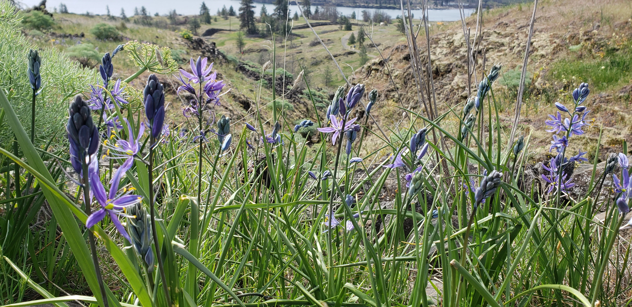
Sunday was our last day so for a shorter hike, we went to the Catherine Creek nature area. This has a shorter loop, also rated moderate and it is less demanding than Coyote Wall. Even better, if you are traveling with mobility impaired folks, there is an all-access (flat, paved) trail there where everyone can take in the wildflowers. Here are a few shots of said flowers. First from Coyote Wall trail:
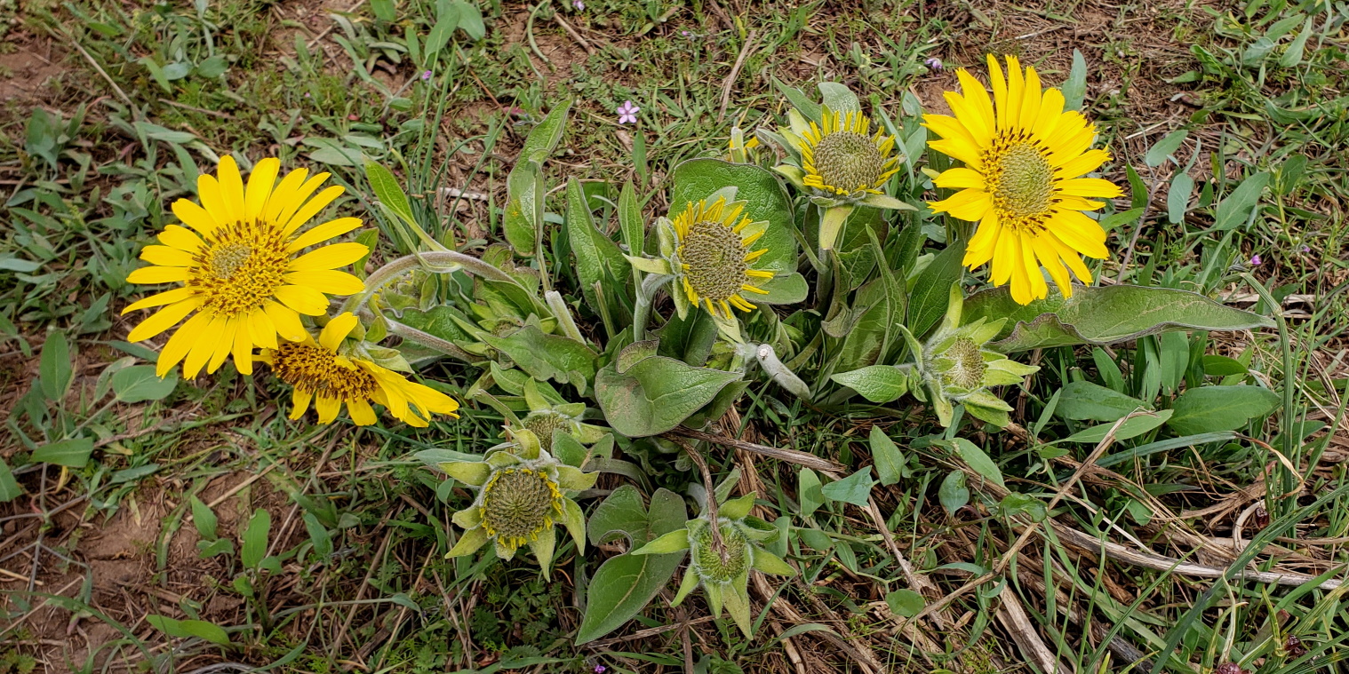
And from Catherine creek.
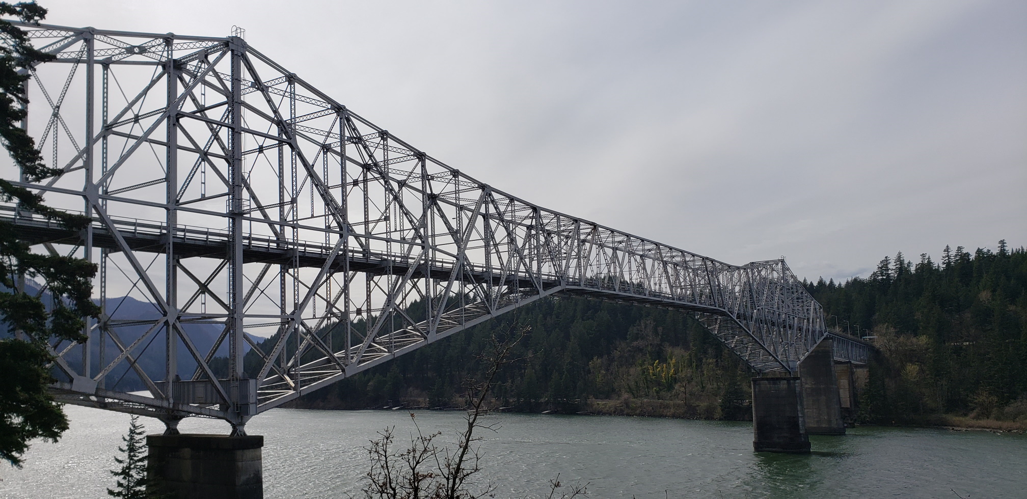
On the way back, we stopped at Cascade Locks, a little town whose claim to fame is the ‘Bridge of the Gods.’ Ahem. It’s a nice bridge, and impressively engineered, but the name is perhaps a bit hyperbolic.

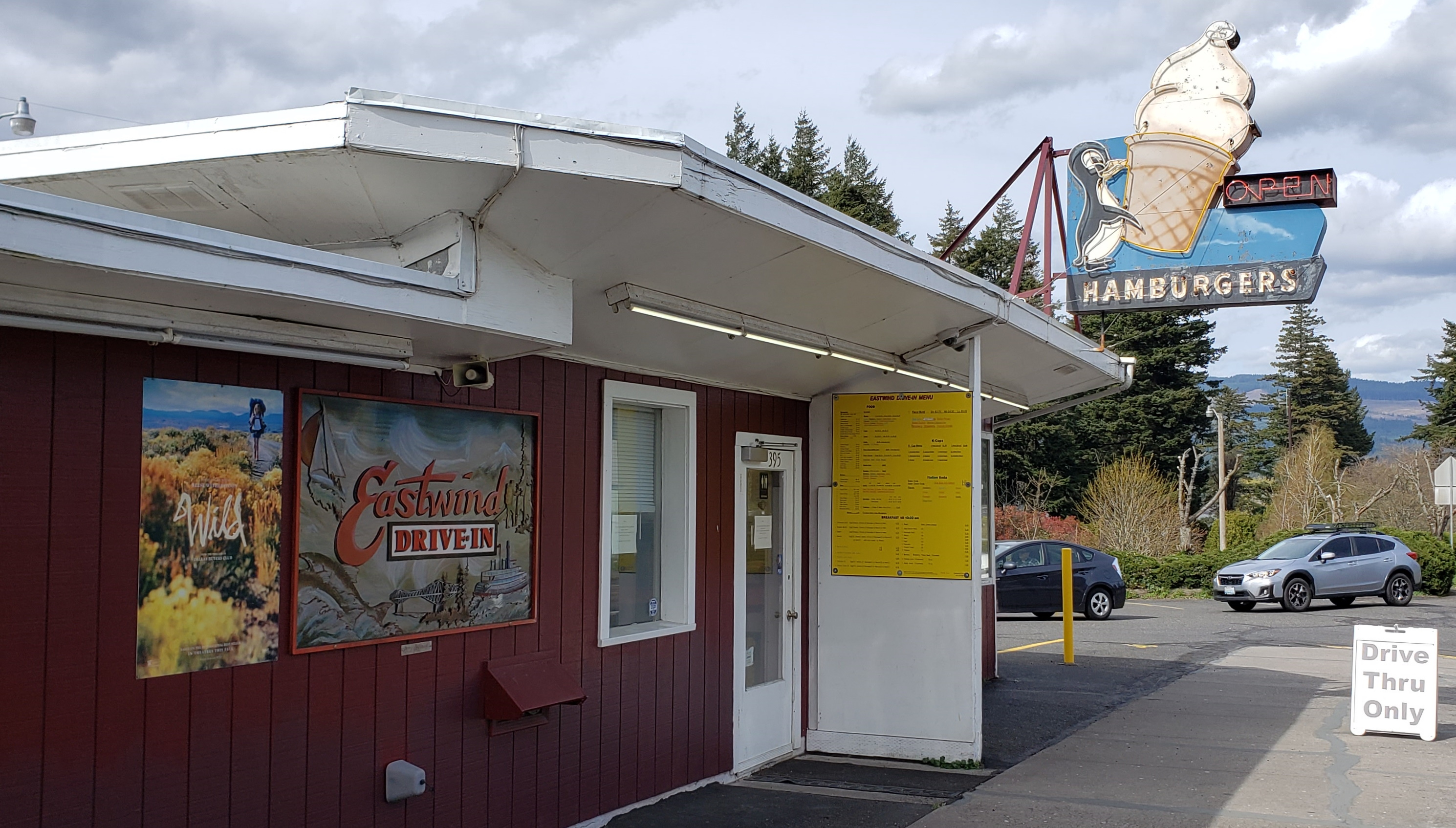
They also have an old fashioned burger place, the East Wind drive-in. We just had soft-serve. This is their vanilla and mocha cappucino (photo right). That’s a ‘small’ size. Yeah, America has an issue with portion control. More importantly for the many road bikers riding the gorge, there is a plaza mid-town with restrooms, shower, workstand for your bike and great views of the river.
That was it for our trip. Back to Portland 40 minutes later. Portlandia has a lot going for it but one of the best parts is its location. Within an hour or two of the gorge, the mountains, the sea, and the desert, there is a little of everything for everyone here. Including rain. Enough rain for everybody. That’s okay, it makes the flowers grow.
The East Wind. This is old school cool.
Note: I did not take the Olympus on this trip, so all photos are from my Samsung Galaxy 9, so not the quality I usually have on the blog. I do not have any association with any businesses mentioned in this entry. Or Olympus for that matter.

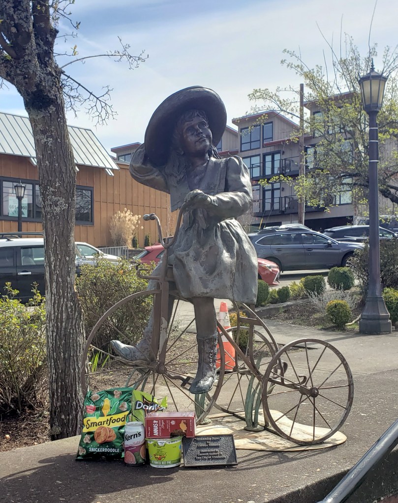
Re the statue’s cache of snacks: I live on the opposite coast, in an urban area. Early in the Pandemic, I noticed similar incongruous goody piles. Apparently folks were leaving their comestibles on park benches, etc., since local food pantries were inaccessible to both would-be donors and recipients. (Food outreach programs for the homeless were also greatly affected.) The phenomenon has decreased as public health improved, but perhaps people still enjoy the opportunity for small, anonymous acts of sharing and generosity.
LikeLike
Thank you for sharing an uplifting perspective on the snack pile! We’ve got a few good souls in Portland who have set up their own food shares as well.
LikeLike